Map Links
Disclaimer!!!
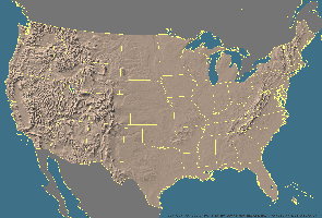
None needed for this section. I use a program called Vistapro (by Virtual Reality Labs) to input Digital Elevation Model (DEM) files to get accurate 3D representations of existing U.S. landform elevations for viewing from any angle. I also use a program called Point Of Vision RAY-tracer (POVRAY) which is a powerful public domain ray-tracing package to give these landforms photorealistic qualities (look under the taboo links section for UFO's and Area 51 to see a sample of what can be done with POVRAY). I am in the process of downloading the entire U.S. digital landform database and putting it on CD ROM. Once I finish that project, I should have the entire database here on this site for faster retrieval of the files.
I cannot guarantee how current these links are. Since sites change so quickly on the Internet, some of these sites may no longer be active. If you find a link that is no longer working or you have found a site I should add to this list, please make a note of it, to me, using the mail link below.
Changes, & general suggestions should be forwarded to: bswearin@folio.com
Table of Contents
Digital Files for Elevations
General U.S. Maps
Digital Files for Elevations
General U.S. Maps

Home Page (bswearin@folio.com)
